

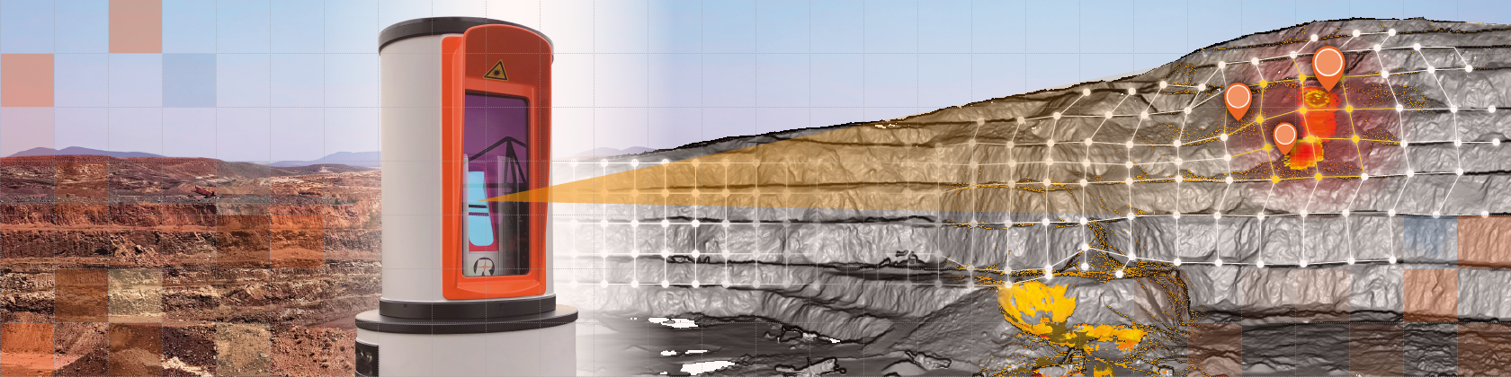
Slope Monitoring

MONITORING THE STABILITY OF SLOPES AND DUMPS
Open pit mine design seeks to optimize the safe and effective extraction of an orebody. Design assumptions and the stability of the excavated pit slopes are monitored to assess the performance of the slopes and the design. The measurement and evaluation of deformations of benches and slopes are indispensable for movement detection and geotechnical assessment, to enable proactive risk management and mitigation.
SYPERION’s monitoring system is the ideal solution for long-term campaign or strategic monitoring. The data is captured in absolute 3D-coordinates with point precision, accuracy and repeatability.
HORTS Mining Solutions delivers the robust technical infrastructure required to seamlessly integrate the system into even the most demanding mining environments. Built on decades of mining expertise, our companies combine proven know-how with a strong global track record. With more than 15 installations worldwide, our solutions are engineered for demanding 24/7 operation and have demonstrated reliable performance for over 30 years.
SYSTEM SET-UP
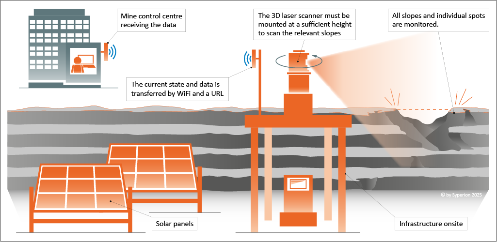
Mounted on a stable platform, the high-specification 3D laser scanner captures a complete data set of the entire pit every hour. This data set – known as a point cloud – provides full coverage of the monitored slope. The point cloud is automatically transformed into vertical (top view) and horizontal (scanner view) grids, represented by millions of GridPoints. Each GridPoint is continuously tracked over time, enabling precise analysis of even the smallest surface changes. Of these millions of GridPoints, hundreds of thousands remain exceptionally stable over time – with a standard deviation of less than 2 millimetres. These highly reliable reference points are called VirtualPrisms. Hundreds of VirtualPrisms can be configured in just minutes, delivering continuous, high-precision displacement monitoring – with no manual intervention in the pit required.
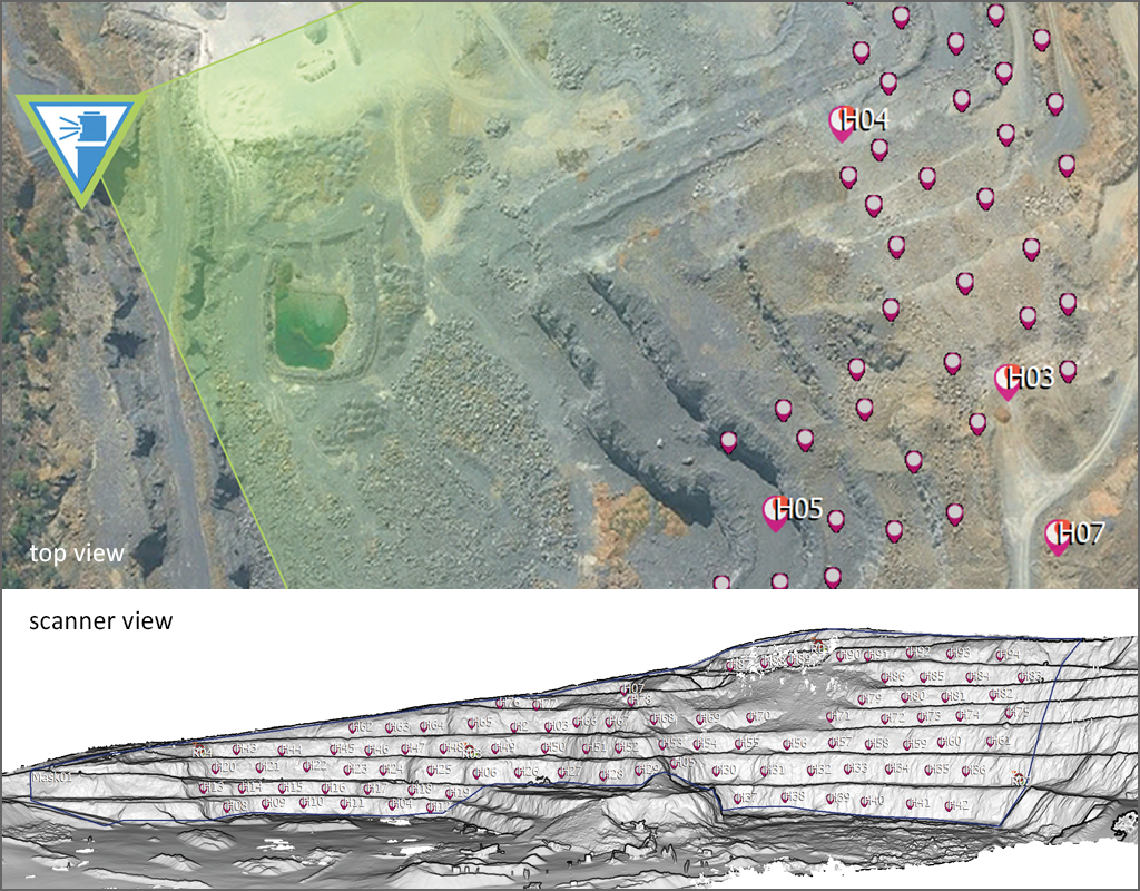
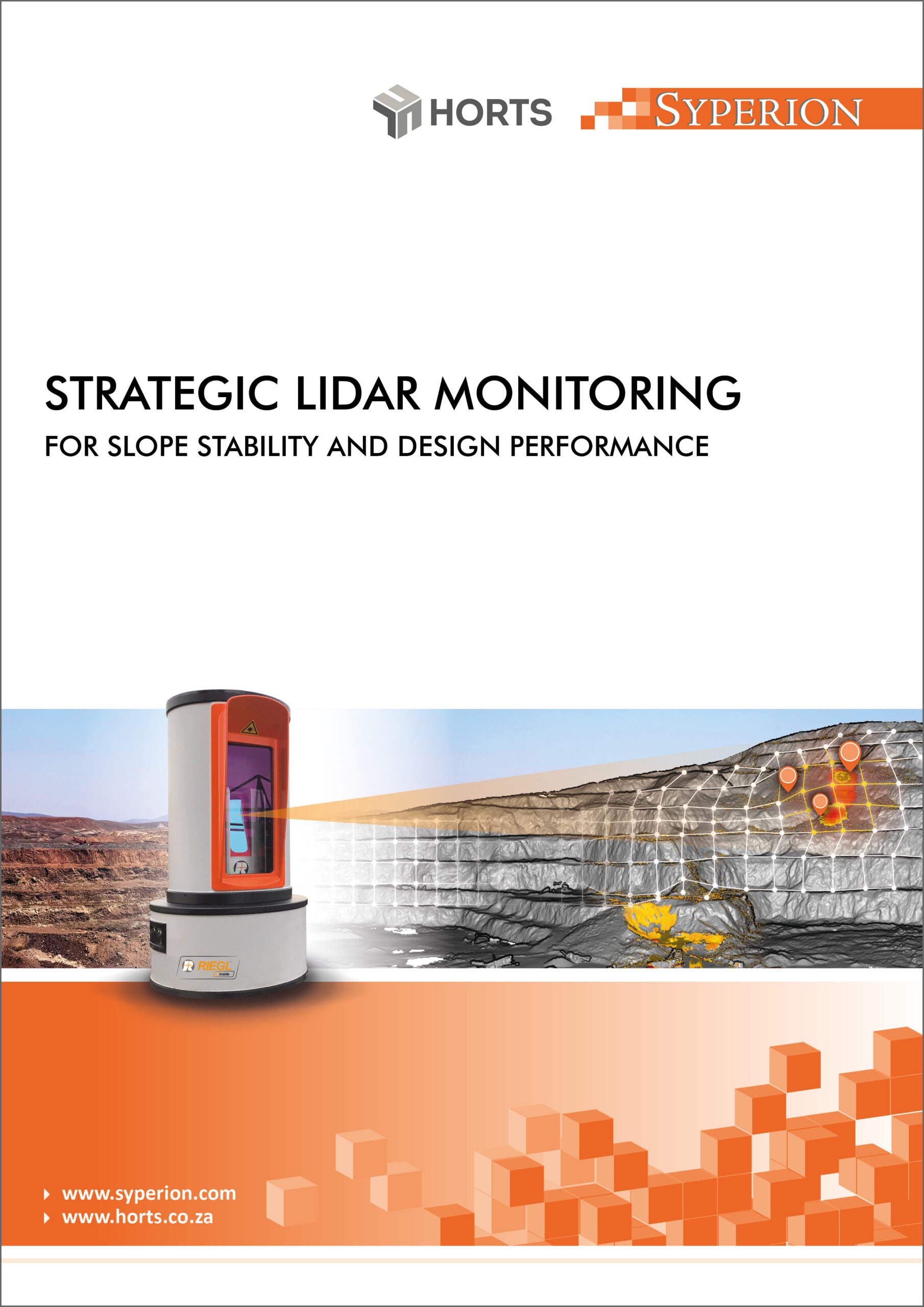
The pictures below shows the top view and the scanner view of a pit with the position of the laser scanner and its field of view. The purple position markers represent the VirtualPrisms.


Scanner View
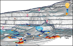
Scanner view:
Full-field view of the slopes, in which the displacements relative to a reference are shown in red and blue.


Analysis
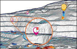
The user defined VirtualPrisms on the slopes which are exceeding the thresholds are highlighted in purple position markers.


Slope Failures
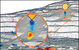
Slope failures and falls of ground can be easily identified and quantified, even if no VirtualPrisms are set in this area.


Graphical Illustration
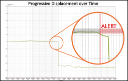
A graph shows the displacement of a single VirtualPrism over time and indicates a failure shortly after the displacement exits the tolerance range.
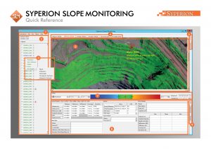
Click here to see a quick reference of the
SYPERION Slope Monitoring.
SAFETY & RISK MANAGEMENT
Continuous Slope Surveillance
Long-term, real-time monitoring of slopes in open pit mines for optimal operational safety
Strategic Monitoring Guidance
Intelligent decision support to guide the use of tactical and critical monitoring tools
Comprehensive Data Analysis
Full slope coverage combined with individual prism-level insights for a complete slope stability assessment
Minimize Costs & Risk Exposure
Proactively identify instabilities before they become critical – protecting people, assets and operations
GEOTECHNICAL BENEFITS
Slope Compliance Monitoring
Enable continuous adherence to geotechnical safety standards and regulatory requirements
Advanced Geotechnical Visualization
Monitor and visualize moisture distribution, strain patterns and joint behavior in an integrated view
OPERATIONAL & PRODUCTIONAL BENEFITS
Seamless 3D Data Export
Full pit geometry available in industry-standard formats for direct integration into your workflow
Optimized Pit Design
Leverage precise 3D data to refine and validate pit design for maximum efficiency and safety
Integrated Rock Mass Information
Overlay geological data directly onto 3D models for informed decision-making
Accurate Volumetric Analysis
Reliable volume calculations to support production planning, reconcillation and reporting

Processing
monitoring data in...

Processing
monitoring data in...
Contact
Please contact us and we will help you to develop an optimal solution for your application.